logo    "It all begins with the Map!"
Downloadable PDF Version

GeoElections News

January 2016dot Temple Terrace, FL dot www.icwmaps.com VOL. 13 NO.1 - star$.50
underline

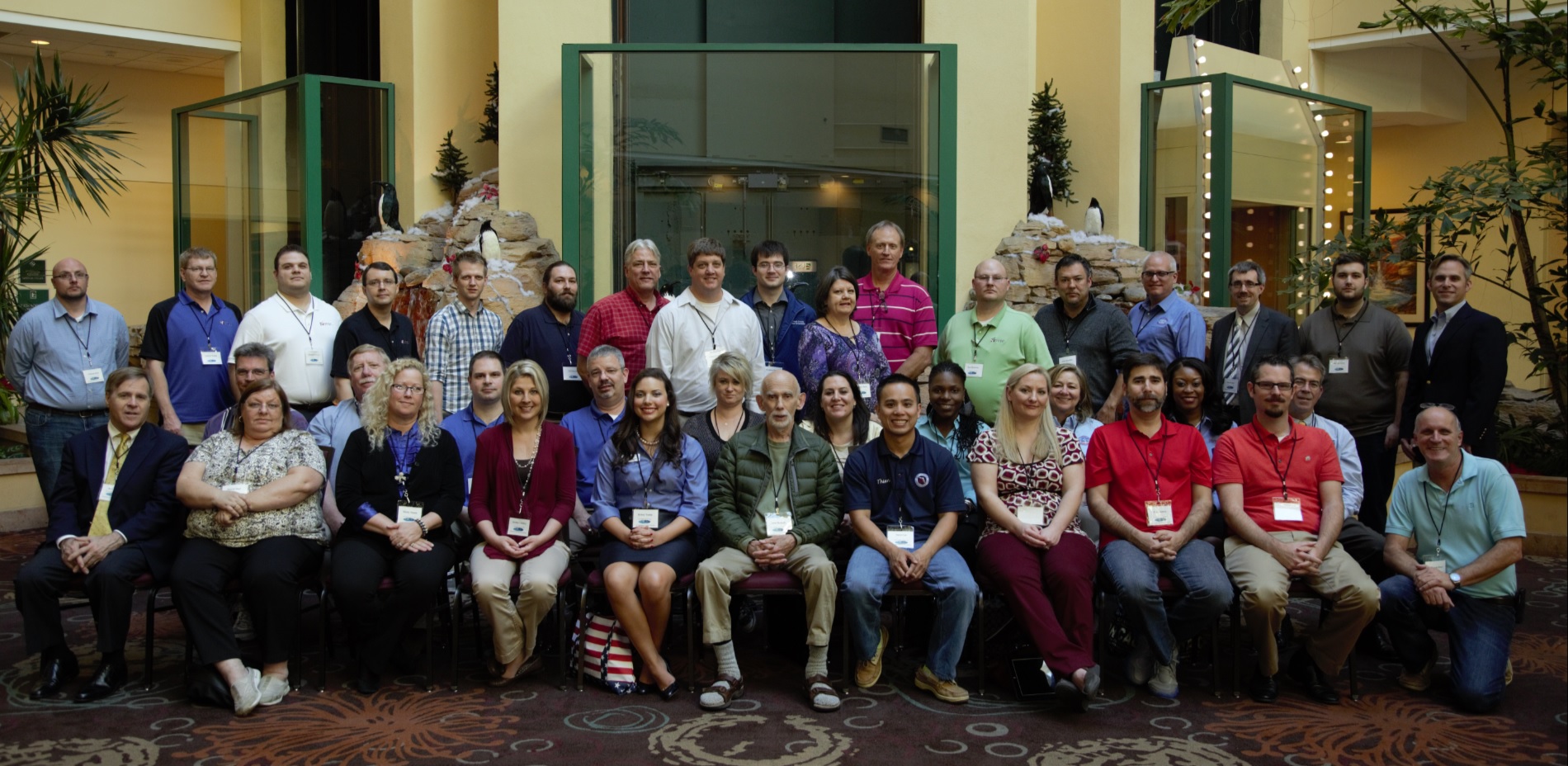
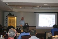
The 14th Annual GeoElections User’s Conference – December 2015

Another outstanding Conference this year for veterans and new users alike. With over 40 GeoElections Users, four guest speakers (listed below) and technical presentations provided by the ICW staff, the Conference presented a great opportunity for both professional networking and relevant content. The topics discussed ranged from a review of the Florida Supreme Court Ruling on the US Congressional District lines rendered a week earlier to new features in the 2nd major release of a 64 bit version of MapInfo Professional. The attendees were also treated to a video featuring one of their counter parts demonstrate his personal resolve to land a 5 foot Cobia, almost as large as him, while fishing in the Gulf from his kayak. This video and Power Point presentations are available at www.icwmaps.com. GeoElections Users from three states attended the event for which most were available for our annual group photo. An enthusiastic group of attendees fired off questions and shared suggestions on methods for expanding the uses of their GeoElections data bases to increase benefits for the voting public.

embassy

GeoElections Users from three states attended the event for which most were available for our annual group photo. An enthusiastic group of attendees fired off questions and shared suggestions on methods for expanding the uses of their GeoElections data bases to increase benefits for the voting public.

iraIra Pyles, ENP, 9-1-1 Emergency Operations Manager for the Hillsborough County, FL 9-1-1 Agency provided an overview of the roll his agency plays pertaining to street naming and addressing. At the same time Ira explained their roll coordinating municipalities and the US Postal Service to clarify the official street names and addresses elections staff can rely upon when constructing their street indexes for voter registration. Ira pointed out that while each county may place this responsibility with a different department, the results should be universally alike.

iraTamara Holmes, Voter Focus Team Lead, VR Systems, Inc. provided a presentation documenting the various steps GeoElections Users can execute in the process of importing street and jurisdiction data from GeoElections into Voter Focus. Tamara identified the need to run the integrity checks and always use the Sandbox before importing to the live database.

iraJames Whitehorne, Chief, Census Redistricting & Voting Rights Data Office Associate Director for the Decennial Census U.S. Census Bureau; provided a brief history of the Office he represents. James also delineated numerous data exchange programs the Bureau conducts in partnership with the States in preparation for production of the P.L. 94-171 Data that will be provided to the States for redistricting in 2021-22.

iraElliot Cox, Product Manager for MapInfo Professional, Pitney Bowes, Inc., provided a live demonstration of the 64 bit version of MapInfo and discussed numerous enhancements PB has incorporated into the current version of the 64 bit version of MapInfo Professional. Elliot spoke of the ongoing commitment PB has regards feature enhancements to MapInfo Professional meeting the demands of clients. He encouraged clients to use the 64 bit version for creating cartographic products.


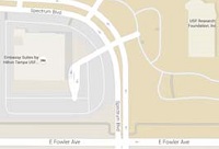
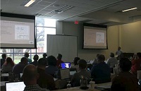
GeoElections User’s Conference Expands To The USF Research and Innovations Conference Facilities

book

The 14th Annual Conference presented organizers with an bookinteresting set of logistical challenges. Because of the large number of late registrants for Thursday, our full day of technical presentations, we could not find adequate meeting facilities at the Embassy Suites Hotel. With the availability of the USF Research & Innovations building in such close proximity to the Hotel, we were able to utilize a conference room at this facility and remain on the USF campus. With dual projectors and screens, excellent ambient lighting along with ample classroom style seating and catering provided by the staff from the Hotel, these facilities contributed to the success of our full day of technical presentations which featured the first three of our four guest speakers. Friday was a half day conducted in the Hotel conference room. A new function was added to GeoPoints accessible through the new Conflation Layer menu. This functionality allows bookbookeasy conversion of external point files to the record layout used in GeoPoints which also includes the ability to select a point from the external file and use the Add function to append the point to an existing GeoPoints file. As more GeoElections users adopt points to represent business addresses, polling places and residential structures this new functionality will save time.


book

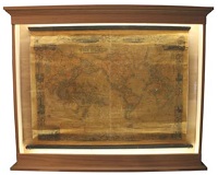
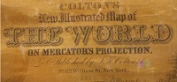
A discussion illustrating several techniques useful in labeling maps for publication as PDF files, web mapping, or paper maps was enhanced with a comparison of the techniques used in an antique map published in 1855. bookThe Colton map is contained in a custom case illuminated with LED lights as illustrated below to the left. The map is approximately 46” wide and 32” while the title of the map appears below to the right. The text on the Colton map was all hand placed. The majority of the text created with the data from GeoElections is computer generated and automatically placed on the map regardless the media in which the final image is rendered. Colton maps were published using plates and a printing press. The Colton map provides a unique example of the challenges that have face cartographers since the beginning of time to the present regarding the art of text placement regardless the automation available today.