 "It all begins with the Map!"
GeoElections News
 Temple Terrace, FL www.icwmaps.com VOL. 16 NO.1 -
  $.50
$.50 
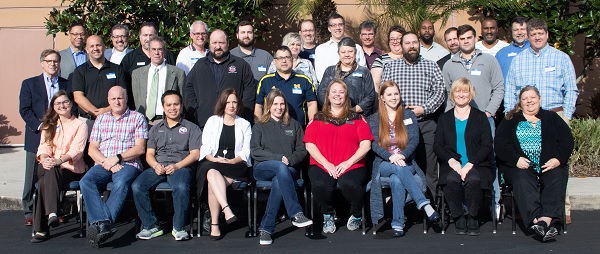
The 17th Annual GeoElections User’s Conference – December 2018
Another outstanding GeoElections Conference was conducted for veterans and new users alike. With guest speakers from the US Census Bureau, James Whitehorne, Chief Redistricting and Voting Rights Data Office, Jennie Karalewich, Lead Redistricting Program Specialist, William D. Boyett, Chief Deputy Supervisor of Elections Alachua County and presentations by the people at ICW, the Conference was a great opportunity for both professional networking and information rich content.
The conference this year focused upon the Verification Phase of the VTD Project and the release of GeoAuthorVTD 2018.2 to work with the Partnership Shapefiles VTD Verification Phase. These files are available to download from https://www.census.gov/geo/maps-data/data/partnership.html. These files can be used with GeoAuthor VTD 2018.2 which can be downloaded from https://www.icwmaps.com/downloads.php. The activation code for installing GeoAuthorVTD 2018.2 is 182VTD18353 followed by the ICW client identification code. GeoElections Users from two states and speakers alike made the 17th a great conference!
|
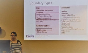
Jennie Karalewich, Lead Redistricting Program Specialist, described numerous entities to view, correct if necessary and add as required.
Jennie, discussed the concepts of Census Geography, the review process for the VTD Phase, the Verification Phase and submission guidelines. |
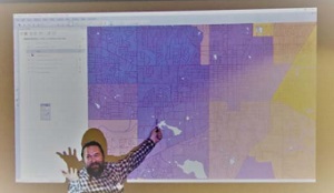
Will Boyette, Chief Deputy SOE Alachua County described how he used data from his VR system to map the effectiveness of early vote sites.
Entitled “Visualizing Voter Focus Data With Thematic Maps”, Will provided a step-by-step guide available at www.icwmaps.com for users to follow. |
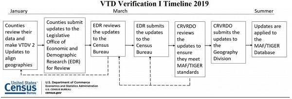
VTD Project Update - Verification I
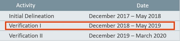
During the first quarter of 2018 the Census Bureau conducted the Initial Delineation phase. At this time the Census Bureau is conducting the Verification I phase. Participation is in any subsequent phase is dependent upon participation in the prior phase. During the Verification I phase currently in process, participants may engage in the numerous data activities all of which are supported by GeoAuthorVTD 2018.2:
Activities
• States provide their Election Districts/Precincts/Wards
• States can review linear features and make any updates to improve TIGER addressing
• Add/Delete features• Update Area Landmark (state parks, prisons, etc.) boundaries
• Correct misaligned features
• Suggest updates to legal boundaries
GeoAuthorVTD 2018.2 is specifically designed to work with the Verification files. The controls are identical to the functions used in GeoAuthor VTD Edition, as used with the Initial Delineation files. All of the Activities listed above are supported with GeoAuthorVTD 2018.2. As previously delivered, GeoAuthorVTD 2018.2 is a no charge offering from ICW.
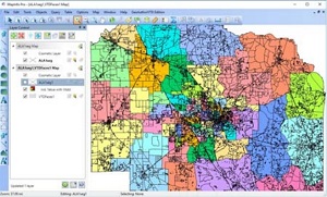
Once you have set up your project, open the VTDFaces1 table located in the VTDFaces folder. Thematically shade this layer using the Vtdst field to see how the Census Bureau handled the data you sent.
You can overlay a copy of your current precincts created with MapMaker from the GeoElections project to confirm the data in the VTDFaces is correct and/or update this data to reflect any changes you have made since the initial submission. You may also want to add new street features.