 "It all begins with the Map!"
GeoElections News
 Temple Terrace, FL www.icwmaps.com VOL. 5 NO.3 -
  $.50
$.50 
|
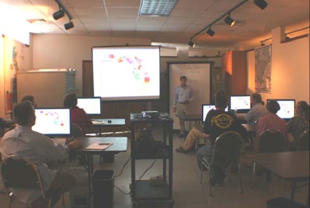
Success! The Seventh Annual GeoElections User’s Conference The headliner at the conference this year was guest speaker Catherine Clark McCully, Chief of US Census Redistricting Data Office. Chief McCully spoke about the 2010 preparations of data for use in redistricting and the opportunities available for Florida Elections officials to participate in Phase II BBSP/VTD Update Program. 
Attendees learned how to use the GeoAuthor® VTD Edition application developed by ICW to assist clients with the easiest to use software with which to participate in the VTD Update Program with the Census Bureau. |
|
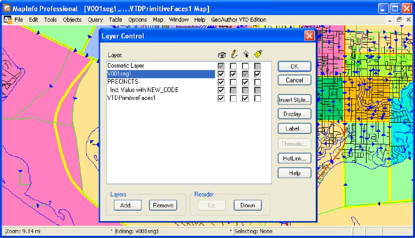
The Development of GeoAuthor® After two years of intense analysis and design, an on going initiative by the people at ICW is realized. Designed for the express use of editing TIGER/Line products from the Bureau of the Census and networks of diverse features from local GIS projects, GeoAuthor® VTD Edition is a derivative product of GeoAuthor® which provides the core technology for working with the VTD TIGER/Line Shapefiles. VTD Update participants now have a set of tools that simplify the data editing and reporting process. ICW Introduced GeoAuthor® VTD Edition Software
|
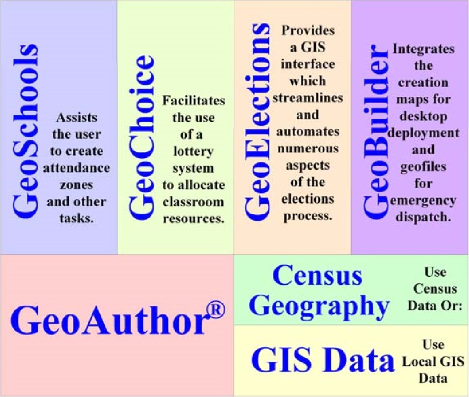
GeoAuthor® Brings New Versatility With Vertical Integration The Development of GeoAuthor® has been an on going initiative by the people at ICW for over two years and is designed with the versatility to leverage significant existing investments in GIS data from multiple sources. In keeping with the rich legacy of vertical application design, GeoAuthor® is the foundation tier upon which a wealth of functionality is poised. The lego block architecture is open ended to support yet unforeseen application demands. Ease-of-use, versatility, powerful functionality, and vertical integration only begin to describe the suite of software ICW delivers and supports with the technology in GeoAuthor®. With GeoAuthor®, the user can make edits to the geometry and tabular attributes of GIS data. This includes realigning TIGER to local geometry (i.e. parcel maps, aerial photos, etc.), adding missing features (i.e. streets, water, jurisdictional boundaries, etc.), edit tabular attributes (i.e. names, address ranges, ZIP Codes, etc.) and use the diagnostic routines in GeoAuthor® to confirm the integrity of the data. GeoAuthor® also includes GeoPoints© which is designed to create and maintain geographic databases of points with tabular attributes (i.e. file of structure locations, polling places, fire hydrants, parcel centroids, etc.) all of which can be geocoded to for maximum location accuracy. Then vertically integrate your data with your discipline specific application. |
|
Pitney Bowes Business Insight
In September 2007, Pitney Bowes brought together two industry leaders — MapInfo and Group 1 Software — bringing the best of both worlds to its customers, partners and prospects. Now operating as one division called Pitney Bowes Business Insight we offer a unique combination of location and communication intelligence software, data and services that can be leveraged throughout an organization. Offering an array of location intelligence, data quality and communication management capabilities, Pitney Bowes Business Insight will increase the accuracy and effectiveness of your customer information delivery and drive better decisions. We enable you to improve your business today, build the path for future growth and allow you to leverage your customer data for more insightful decision-making, improved customer communication and increased profitability. VTD Update As Easy As 1, 2, 3 1. Get your VTD TIGER/Line Shapefile from your State Liason, in FL, John Guthrie, (850) 487-487-5855 then create and setup your GeoAuthor VTD project. 2. Add lines (the Census calls these Edges) into the network of Edges to define VTD boundaries where lines do not exist. Run a GeoAuthor VTD Edition routine to create polygons from the closed areas in the Edges network (the Census call these Primitive Faces).
3. Update 3 columns in your table of Primitive Faces. You can use your precincts as a starter. Run the GeoAuthor VTD Report and build a file to submit. |