logo    "It all begins with the Map!"
Downloadable PDF Version

GeoElections News

December 2017dot Temple Terrace, FL dot www.icwmaps.com VOL. 15 NO.1 - star$.50
underline

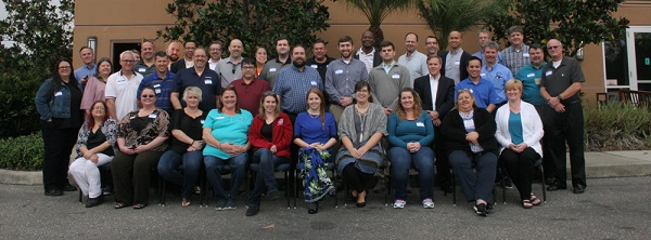
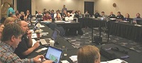
The 16th Annual GeoElections User’s Conference – December 2017

Another outstanding GeoElections Conference was conducted for veterans and new users alike. With a guest speaker from the US Census Bureau, Colleen Joyce (listed below) and presentations by the people at ICW, the Conference was a great opportunity for both professional networking and information rich content.

The conference this year was dominated with a workshop based upon the US Census Phase II Data Redistricting (VTD) Program and the release of GeoAuthorVTD Edition. The people at ICW developed GeoAuthorVTD Edition to work with the VTD Partnership files. This is the 3rd decade ICW has offered software for this purpose. We conducted a one and a half day workshop learning how to edit the VTD Partnerships Shapefiles for return to the US Census Bureau. These edits included adding new features, updating municipal boundaries, adding hydrography, landmark areas and defining VTDs to define the boundaries of Census Blocks in the 2021 P.L. 94-171 version of the TIGER/Line Shapefiles. GeoElections

2017 group photo

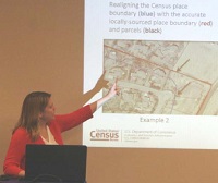
Colleen D. Joyce, Assistant Chief, Census Redistricting & Voting Rights Data Office described numerous entities eligible to update within the Phase 2 – Voting District Project. Colleen is describing how to update a Census Place boundary in this photo.

colleen

crowdThe one and a half day workshop provided our attendees with a comprehensive understanding of how to use the software, the Census data and their own data as a reference for making updates for return to the Census Bureau.

ken Ken Tozier provided step-by-step training in the use of tools, procedures, the Help system and User Manual for GeoAuthorVTD Edition prior to the hands on workshop.


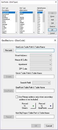
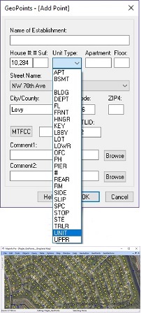
What Is New With The GeoElections Suite of Applications

In the State of Florida we are seeing a trend to move from the traditional ranged addressing to discrete points to identify different households for voter registration.bookbook The Secondary Address Unit Designators described in US Postal Publication 28 can most effectively be deployed with discrete points. In multi-unit residential facilities, the secondary address is necessary to distinguish one residence from another. Points also handle residences set far enough off the street to place them in a precinct with a ballot different than the one assigned using the ranged addressing from the street segment. The degree of precision discrete points offers gives greater control to the elections officials and staff to eliminate addresses that do not exist other than in a generalized range. The map below illustrates the density of households at the roof topin contrast to the traditional 100 to 198 addressing style of ranges. While dense, there are fewer addresses than would exist in a range. This can eliminate the potential for someone to register to vote using an address that does not exist. ICW has added the ability to designate a list of secondary unit types for the pop-down list when adding a GeoPoint. The geocoder has always worked with ranges, but now has been modified to control how strict the rule for use of secondary address unit designator should be applied. A great point of beginning in building these files starts with the local E911 Coordinator and/or property appraiser. Typically, data created by another governmental agency is purpose built to serve the management goals and objectives of that specific agency. While the data may be perfect for their needs it may not be suitable for use by our elections officials.