
 "It all begins with the Map!"
From One Map Source
ICW empowers the people who manage 911 databases.
GeoPointsSQL© powered by Microsoft SQL Server, and support tables from any GIS source bring the ease-of-use offered by GIS to the creation of 911 databases.
ICW brings you a GIS solution designed for 911 database administrators specific to your needs while offering the ability to integrate with existing GIS and interoperate with existing 911CAD systems.
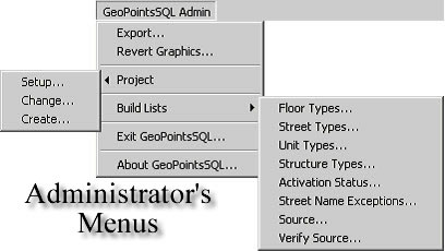
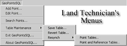
Intuitive, Menu driven
Designed to manage the creation and maintenance process, GeoPointsSQL© brings resources to the range of tasks confronted by both the Administrator and Land Technicians. Including features such as:
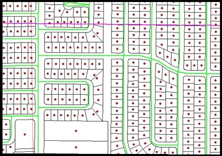
Easy-to-use Mapping
911CAD databases can maximize the benefit of Phase II FCC rules require wireless carriers to provide more precise ALI. The X,Y coordinates of the wireless caller can be related to the closest discrete address within the 911CAD database.
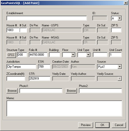
Easy Data-Entry
The 911CAD database before and after GeoPointsSQL©:
| Before | After | ||
|---|---|---|---|
| 1. | Decide upon a system to track street names and addresses either by ranges or discrete locations | 1. | Login to GeoPointsSQL© |
| 2. | Get out maps and colored pencils | 2. | Add a point to the map at the center of the parcel or upon a roof top in a photo |
| 3. | Assign an address and fill out forms | 3. | Select a street the address is associated with and execute the add function |
| 4. | Hand the forms to the data entry clerk | 4. | Complete the data-entry using the GeoPointsSQL© form and depress the OK button to add the record to both the map and database in one transaction |
| 5. | The data entry clerk then enters the information into a tabular database | 5. | Export to the 911CAD database used in dispatch including the mapped points |
| 6. | Export a file to import to your 911CAD database used in dispatch and hope the data can be mapped After | ||
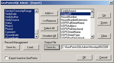
Export to 911CAD Database
GeoPointsSQL© is a multi-user solution for 911 database admin.
Call for additional details about GeoPointsSQL©.